Portrait of Milos Popovic
Milos Popovic

GIS Consultant &
Product Strategist

I help teams turn spatial data into high-impact maps, visual stories, and shippable geospatial products.

Case Studies

From messy inputs to work people actually use

I typically help clients narrow the spatial question, prototype the right visual direction, and turn that into something ready to publish or ship.

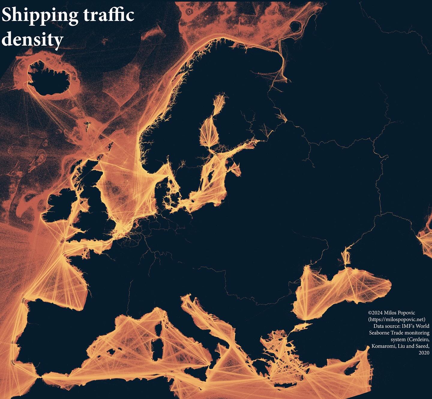
Trade & Transportation

Shipping Traffic Density

A striking visualization showing shipping lane density with glowing lines on a dark background, revealing the arteries of global trade around Europe.

  • High-resolution map (print and web formats)
  • Reproducible R script
  • YouTube tutorial walkthrough
Rsfggplot2dplyr
Open case study
Urban Studies & Satellite Imagery

Nightlight in Ukraine (2021)

A compelling animated visualization of Ukraine's nightlight emissions, highlighting urban centers and infrastructure patterns.

  • Animated GIF (optimized for social media)
  • Full R code with documentation
  • YouTube tutorial
Rterrarastergganimateggplot2
Open case study
How It Works

A simple engagement flow with low friction

Start with one call. If there is fit, I turn that into a scoped recommendation, a prototype path, or a delivery plan.

What comes out of the first call
  • Clear problem framing
  • Recommended delivery path
  • Next-step scope or prototype brief
  1. 1

    Discovery call

    We clarify the problem, the data, and the outcome that matters.

  2. 2

    Recommendation

    I propose a focused plan, timeline, and deliverable shape.

  3. 3

    Delivery

    We move into production support, map making, or team training.

Work Together

Ready to turn your spatial data into something sharper?

Whether you need a signature map, a product strategy sprint, or a training program, the fastest next step is a short consultation.