Population of Egypt
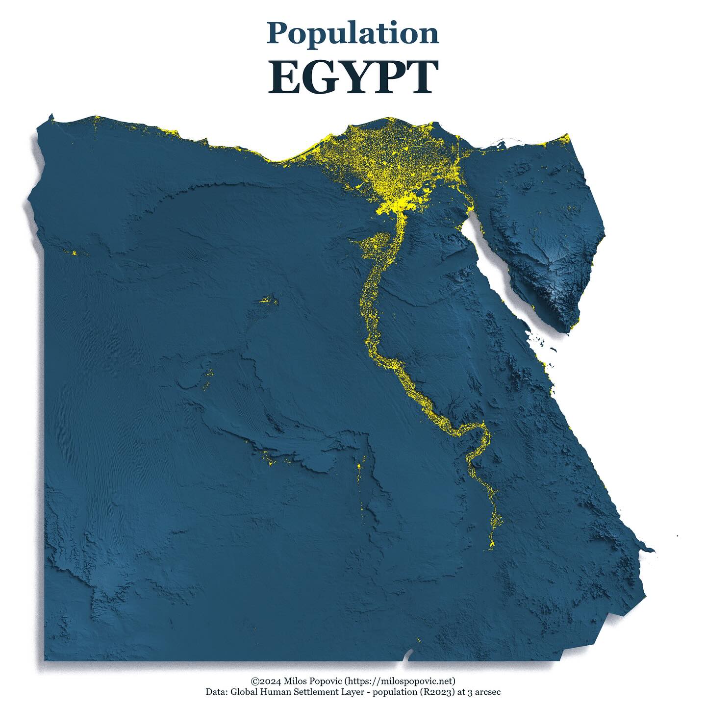
A stunning 3D relief map of Egypt showing population distribution along the Nile River, highlighting how settlement patterns follow the river valley.
Problem
Egypt's population is uniquely concentrated along the Nile River. A 3D visualization dramatically shows this geographic constraint on human settlement.
Outcome
A striking 3D population map that immediately communicates how the Nile defines where people live in Egypt, with population shown in yellow against blue terrain.
Method
Used rayshader package in R with Global Human Settlement Layer population data. Applied custom lighting and color scheme to emphasize population along the river.
Deliverables
- High-resolution 3D render
- Reproducible R code
- YouTube tutorial
Results & Impact
Popular example showing how geography shapes human settlement, widely shared in educational contexts.
Source: YouTube & Instagram Analytics (2024-10) — Based on tutorial views and engagement
Tools
- R
- rayshader
- sf
- raster
- ggplot2
Data Sources
- Global Human Settlement Layer - population (R2023) at 3 arcsec
Want a map like this?
Let’s scope your project and define the fastest path to impact.
Book my consultation